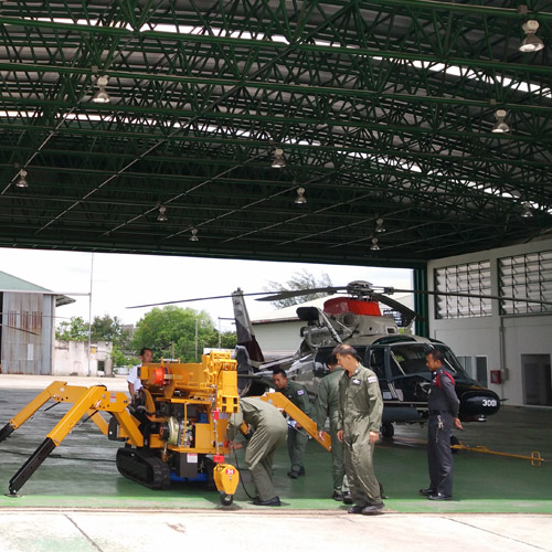
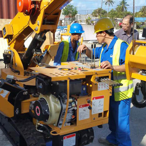
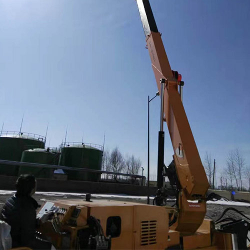
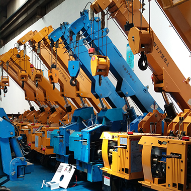
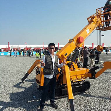
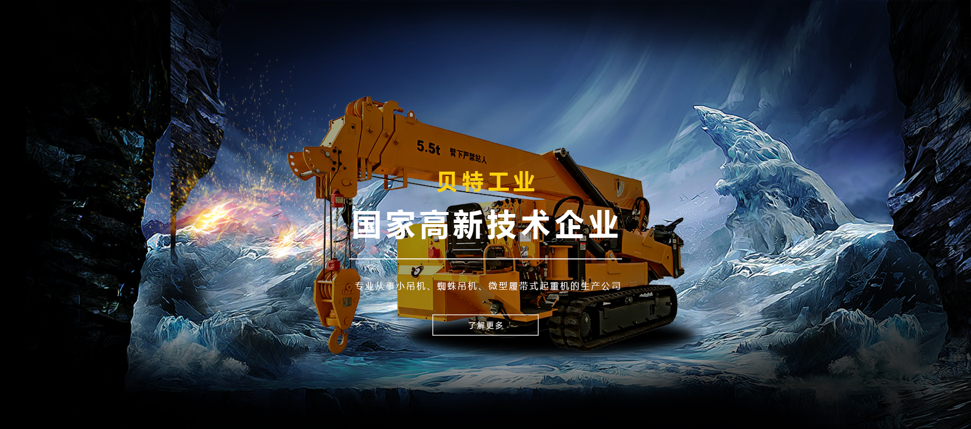
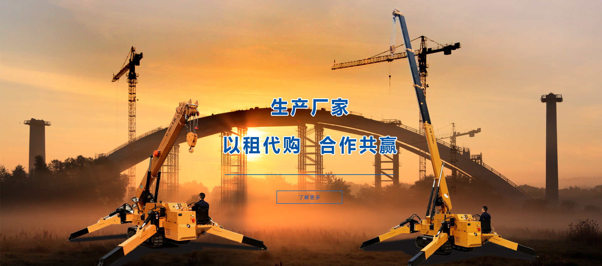
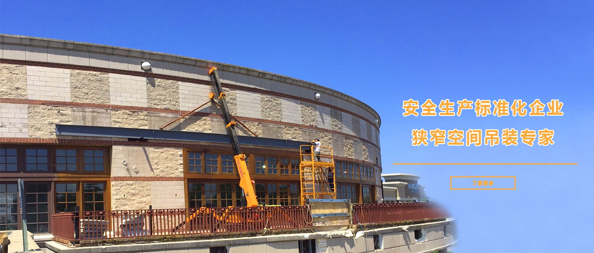
Ram Janaki Darshan
Travels & Tours (P) Ltd.

Makalu Base Camp

20 Days & 19 nights


Day 01: Arrival Kathmandu

Upon your arrival our representative will meet and transfer you to the hotel.


Day 02: Kathmandu – Tumlingtar – Mane Bhanjyang (1100m)

After an early breakfast transfer to the airport for the short 35 minute flight to Tumlingtar. We fly above mountain ranges before reaching Tumlingtar which sits on a wide plateau in the Arun Valley. Here we will meet our transport and drive to the start of our trek.


Day 03: Trek from Mane Bhanjyang to Chichila (1840m); takes about five hours

Leaving civilization behind today the countryside becomes much more rural. We turn left near the school at the northern end of Mani Bhanjyang, and climb through bamboo forests and along a ridge to Arun Than (1280m). From here we traverse a hillside and continue climbing through fields and bamboo groves to Sheka (1350m) and the Tamang Village of Bhotebas (1740m). Beyond the village cultivated fields disappear as the trail climbs through trees to a pass at 1840m offering spectacular views of Chhamland, Makalu and Jaljale Himal. Descending to the next ridge we follow a crest and onto a deep damp forest of rhododendrons and ferns. After 1 -2 hours we reach Chichila and our camp for the night.


Day 04: Trek from Chilchila to Num (1500m); takes about five hours

Following a ridge through forest we pass the small Sherpa settlements of Baisake and Kuwapani (1870m) before passing by mani walls at Sakuranti Majuwa (1860m). The main part of the village is just below the ridge. Our route climbs for a short time and then drops into deep oak forests alongside a stream for a short distance. We then climb along a ridge line to a large expanse of forest that has been burned to make fields to support the ever-growing population of the nearby villages.

Mure, a spread out village at 2000m is inhabited by both Sherpasand Rais. Below Mure the trail passes many tracts of burned trees where more fields are under development. The route cuts across a ridge and descends on a rocky and eroded trail to some stone steps before our final approach to Nun. Nun is on the ridge above an S-shaped bend in the Arun Kosi. On the opposite side of the Arun is Sedua and the peaks that flank the Shipton La.


Day 05: Trek from Num to Sedua (1540m); takes about five hours

The trail descends steeply from the western end of the Nun ridge through the cornfields of Lumbang. Below Lumbang the trail becomes very steep as it drops on slippery rocks through jungle to a suspension bridge over the Arun Kosi at 620m. From the bridge the trail climbs steeply to a primitive teashop at 820m, then through rice, corn and buckwheat fields. The landscape here is picturesque with tiny terraces planted with corn and barley. Finally we make a long climb to Sedua.


Day 06: Trek from Sedua to Tashi Gaon (2070m); takes about three hours

Climbing along the ridge from Sedua we pass the National Park Forest Nursery project and then climb gently northward through rice fields to Manigaon on the next ridge. There are several streams to cross that may or may not have bridges. From Manigaon the trail turns west and makes a gradual climb high above the Kasuwa Khola to a mani wall at 1890m. It’s an easy walk through terraced fields and forested areas to Hindrungma village and on to Ropesa, where we may find monks sitting beside the trail collecting donations for the small gompa nearby. Our route crosses meadows and several streams before reaching the Tashi Gaon School and eventually the village proper. This is the last permanent settlement in the valley. We make the long climb on a stone staircase to thee corn fields at the top of town at 2070 metres which is our campsite.


Day 07: Trek from Tashi Gaon to Khongma (3560m); takes about six hours

This is a tough day, with an elevation gain of 1400m on a steep trail. Initially climbing over a ridge we pass by a herders’ hut and then the trail levels out and climbs to a shepherds’ hut called Chipla atop another ridge at 2520m. The route now becomes steeper with switchbacks through forest to Unshisha, a tiny meadow at 3180m. Once we gain the ridge we will continue a short distance through sparse forests before making a final descent to Khongma (3560m). There are no buildings and many of the tent sites are on the sloping hillside in this often muddy camp site. Stay overnight in tented camp.


Day 08: Trek from Khongma to Dobato (3550m) via Shipton La (4216m); takes about six hours

Steep switchbacks take us to the top of the ridge at 3840m where there is a stone chorten adorned with prayer flags. This is a superb viewpoint with Makalu in the distance. Following along the ridge line through rhododendrons we ascend a stone staircase, and few false summits along the trail, before gaining a side ridge. This is Ghungru La (also known as Tutu La; 4050m), the first of the three passes we cross to reach Barun Khola. Descending to a small lake we then climb steeply up a shallow gully to our major pass crossing – Shipton La. The pass was named when Eric Shipton and Sir Edmund Hillary used this route enroute to Dharan after their 1952 Everest reconnaissance. Descending from the La we pass two lakes at 4020m, and climb through large boulders to Keke La (4150m). On the other side of the pass the route enters a valley filled with rhododendron forests. In spring the valley floor is a carpet of brilliant wild flowers. We camp tonight in a meadow known as Dobato.


Day 09: Trek from Dobato to Yangle Kharka (3600m); takes about five hours

Today we travel through huge rhododendrons and forests of fir and birch on our way to Yangle Kharka. Parts of the route are rugged and ill-defined and there is an area where a past landslide occurred. We will need to take care here as there is still threat of rock fall from time to time. There will be a lot of boulder-hopping and streams to jump across. Beyond the worst of the slide area the route traverses alpine meadows with good views of Peak 7. The trees are now birch and scrub rhododendron, and the valley widens. Finally we cross several streams and a wooden bridge to Yangle Kharka at 3600m.


Day 10: Trek from Yangle Kharka to Yak Kharka (4400m); it takes about four hours

The climb starts out gently from Yangle Kharka, passing Nghe Kharka, a large open, grassy plain at an elevation of 3750m on the opposite side of the Barun Khola. Beyond Nghe Kharka, we follow the Barun valley as the river makes a huge shaped curve. The landscape is dramatic and cliff walls rise almost 2000 metres above the river. Climbing alongside a waterfall we pass a swampy meadow and a stream. The trail turns westward and makes a short climb to potato fields and a single house at Jhak Kharka (4210m). Yet another climb brings us to the meadows of Yak Kharka.


Day 11: Trek from Yak Kharka to Shersong (4660m); takes about four hours

Beyond Yak Kharka the trail climbs over a ridge and ascends alongside a moraine formed by the lower Barun Glacier. Enroute to Merek there are excellent views of Chhamlang, Peak 3 (6477m) and Peak 5 (6404m). Merek sits at 4570m in an inhospitable site with some threat from avalanches and rock fall. The trail from Merek climbs through sand and scree alongside the moraine. We eventually pass a ridge where the valley turns slightly north and we enter an alluvial valley bringing Makalu into view. We stay to the eastern side of the valley and travel over a low ridge to Shersong (4660m). Shersong offers some shelter however can be very cold at times. If the weather is clear a walk up to the valley towards base camp or up the ridge is worthwhile.


Day 12: Hike to Base Camp (5000m)

Today is a relatively short trekking day to reach our destination Makalu Base Camp affords stunning views of its south face, with the south buttress of Makalu offering views of Baruntse (7220m), Everest and Lhotse. The Hillary and French base camps are far up the glacier, past Barun Pokhari, and these are now the traditional base camps used by climbing parties to Makalu. Our foray to base camp today is optional, and some may prefer to forgo base camp and climb the ridge north-east of Shersong. This is a spectacular climb up grassy slopes to the top of the ridge. At the 5250m mark there is an outstanding view of Everest, Lhotse and Lhotse Shar as well as both the south-east and north ridges of Everest, along with the Kangshung Face and the South Col. Makalu looms above the ridge to the north.


Day 13: Trek back to Yangle Kharka; takes about six hours

We retrace our steps through the Barun Valley to our pleasant camp of Yangle Kharka.


Day 14: Trek from Yangle Kharka to Khongma; takes about six hours

We continue our descent through the rock-fall area and climb a rocky gully to Mumbuk. Recrossing the Shipton La we make our final descent to Khongma.


Day 15: Trek from Khongma to Sedua; takes about six hours

Today is a long and steep descent back to civilization and as we emerge from the mountains there is time to reflect on the stunning journey we have taken.


Day 16: Trek from Sedua to Num; takes about five hours

Steadily descend through partly forested terrain to the Arun River and climb to Num.


Day 17: Trek from Num to Chichila; takes about five hours

Further drive to Tumlingtar which takes about three hours. Today will be a long but relatively easy day. We descend the ridge to Chichila where we meet our transport and make the drive back to Tumlingtar.


Day 18: Fly back to Kathmandu

An early rise and after breakfast return flight to Kathmandu.


Day 19: Rest day in Kathmandu

Today, entire day is for rest.


Day 20: Final departure

After breakfast, you will be dropped to the airport for flight back home or onward journey.


Package Details

Location :

Makalu Trekking Region

Duration :

20 Days & 19 nights

Package Quotation

For price details email to rjdtt12@gmail.com

-n/a

Package Includes | Excludes


What's included

  • All arrival & departure transfers
  • All land transport involved in the itinerary
  • Hotel accommodation with breakfast in Kathmandu (3 star)
  • Guided sightseeing tour of Kathmandu
  • Camping accommodation with all meals throughout the trek
  • Licensed Guide & Porter during trek


What's not included

  • International or domestic flights
  • Travel Insurance
  • Nepalese Visa Fee
  • Lunch & Dinner in Kathmandu
  • Beverage (hot & cold drinks)
  • Personal equipments
  • Anything i.e. not stated in Cost Include section


Booking Form Please fill all the texts in the fields.

Copyright @
Warning: date(): It is not safe to rely on the system's timezone settings. You are *required* to use the date.timezone setting or the date_default_timezone_set() function. In case you used any of those methods and you are still getting this warning, you most likely misspelled the timezone identifier. We selected the timezone 'UTC' for now, but please set date.timezone to select your timezone. in /home/ramjkt/public_html/includes/footer.php on line 18
2024 : Ram Janaki Darshan Travels and Tours (P) Ltd.